
The kasbah, built around 1688 under the reign of Moulay Ismail, has been amended several times. The center of the city, near the place where the market is held (Tuesday), you will be able to acquire hanbels, large blankets garish hues.
Beni-Mellal was known under the name Day. Next to Day, another small town was born: Soumaa. The Soumaa zawiya is founded by Sidi Ahmed Ibn Kassim Soumai in the sixteenth century. This zawiya had a big role in this region. The merger of these two towns gave Beni-Mellal current.
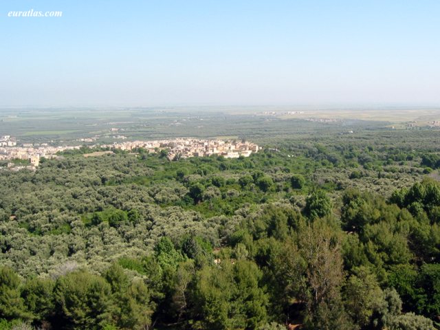
At the entrance of the city, a good road (follow the sign "tour") past the modern building of the province can do around the oasis (625 m) of Beni Mellal, which extends foot of Jebel Tassemit (2248 m). It passes near the source Vaucluse Ain Asserdoun (3.5 Km) around which were arranged charming gardens. From there, a small road goes to the Kasba Ras and Ain (1km), but nicely located in ruins; sweeping views of the city and its surroundings.
About Beni Mellal.

1 - Taghzirt (22 Km north-east by the CT1674) A 10 km from Beni Mellal is the village of Ait Said, established at the mouth of the ravine Foum el Anseur at the bottom of which flows a stream fed by six sources. Springing from cliffs of dizzying heights, they irrigate plantations hackberry, walnut, olive, fig, apricot, orange, banana, etc.. At the top of the cliff several artificial caves were prehistoric shelters. Very difficult to reach these caves have excited the popular imagination: the legend they contain treasures guarded by petrified characters.
Fichtala (about 14 km) is the seat of Zawiya. It was there in 1545 Marmol up Efza, the capital of Tadla. It is probably the Tefza mentioned by the Andalusian historian Leo Africanus, near which the saadien Ahmed el Arej defeated the Wattasids in 1536. We then joined Taghzirt an old bourgae with a kasbah.
2 - Dam and Lake bin el Ouidane (58 Km south by P24, the 1802 and S508A). Beni Mellal leaving the South, we quickly reached the first slopes of the Middle Atlas. A Oulad Moussa (11km), turn left onto 1802. From Ouaouizarth the road (S508A) along the Lake Bin el Ouidane formed by the impoundment of the Wadi el Abid. The rugged mountains of the High Atlas link first identify their walls red and brown the vast expanse of blue water. it is possible to swim from the tourist complex built on the north shore of the lake.
An area equal to that of Lake Annecy, the lake is closed to the west by the imposing dam of the same name. This high curved wall 130 m high and 290 m long, over which passes the road from Azilal Afourer, was built between 1948 and 1955 in a gorge aspect Jura. it feeds a power plant, and allows irrigation of the plain of Tadla. This is one of the most important works of Morocco. A few kilometers downstream is a second high dam, says Ait Ouarda.